|
|
I finally finished the Route Finder for Algonquin Provincial Park. Algonquin is a popular canoeing destination about 3 hours north of Toronto. I added the campsites a couple of months ago and have been working on finishing all of the routes. Just in time for planning season! A point of caution about the Algonquin map - campsite locations and portage locations and lengths have been approximated. At this point the Algonquin interactive map is really for planning purposes only. If you have updated locations and information, feel free to submit corrections. You can do so on the map using the email button. 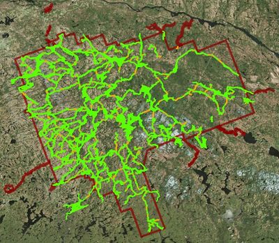
|


