For those of you that have old copies of the Boundary Waters Journal you should check out the prequel to this trip. The article is “The Hard Way to McKenzie” by Darrel Brauer Spring 2009. For those of you who do not have access to old BWJ’s the short story is Darrel and I bushwhacked from a logging road into McKenzie Lake. It took us 2 days to get from the logging road to the lake. Information acquired on that trip and some subsequent trips led us to believe we could get to Kawnipi Lake from that logging road and it would be much easier than the last time. Our plan was to get Doug to drop us off as far down the logging road as he could and we would bushwhack to the Wawiag below the rapids. From talking to locals I had learned that the rapids on the Wawiag were far beyond my abilities. The rapids extend for almost a mile upstream from the park boundary. From exploratory trips I made last summer I knew that beavers had blocked the road about a mile from where I thought we could drive if the road was not blocked but I thought with a little clearing we could get past it. I measured the distance from the beaver dam to where we will put in as about 2 miles using Google Earth. Six years ago I walked 1 & ½ miles of that 2 miles and it was all easy walking. About ½ of it was on a winter road and the rest was a logging road with culverts intact. I convinced Darrel that even if we could not get past the beaver dam it should not take us much more than 3 hours to do the 2 miles even with double carry. That would mean we would need to walk the 2 miles 3 times.
Our plan is to have Doug take us down the logging road and drop us off shortly after noon. We decide to take my car to save time in transferring gear and it has 4 wheel drive. Doug will leave my car at French Lake parking lot. It is about a 2 hour drive from French Lake to where we will get dropped off. By watching my tracks from previous trips down this road I am able to make all the correct turns except one but that error was quickly seen on my GPS. We came over a hill and in the middle of the road was the biggest black bear I have ever seen in the wild. He took one look at us and turned and ran. He was fat and as he ran away it looked like a giant black bowling ball rolling down the road ahead of us. We remarked that there was a lot of bear scat on the road covered with those yellow and black butterflies. Shortly after that we found a large moose shed laying in the middle of the road which indicates we are the first vehicle down this road this year. After nearly 2 hours of driving we passed the place where Doug dropped us off 10 years ago. About a mile more and we are at the beaver dam that is built on top of the road.
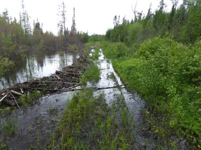
Well the beaver dam is much bigger now and we are not going to clear it in less than several hours of work so we will start from here. Unloading the car and getting it turned around for Doug and wishing him well in finding his way back to RT11 took about ½ hour. He had taken notes as to how far it was to each of the turnoffs and which way we had gone. So Doug is on his way and we start off at the beaver dam and the road looks good.
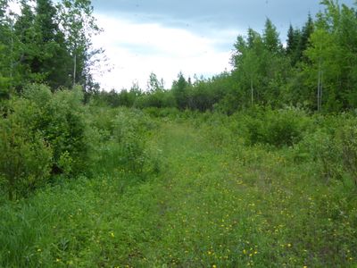
The next ½ mile is the only section between here and where we plan on putting in the Wawiag that I have not walked. About 400Yds down this road a lesser used road tee’s off to the south but when we get there it is not obvious that it is a road because of the bushes growing on it. About 100yds down this lesser used road it improves and I see that the culverts are intact. A little further and we are at what I have called the first parking lot. 6 years ago there were tracks where a 4 wheeled vehicle had turned around and I found a satellite image of what looks like a pickup truck parked in the south west corner of the lot. Today it is difficult to tell that it has ever been cleared of trees. From there it is just down a hill and we are at what I call a hunting camp. There is the remains of a fallen down shed and a stack of building material. Entering the camp it is easy to see a road heading off to the south. I have never explored that road but it must go to the Wawiag above the rapids. Much less obvious is just north of the camp is a much much less used road which I call the winter road. It goes west starting just up a small hill on the north side of camp. 6 years ago this road has some places where there were 3 Ft high brush. Now that brush is 8 to 10 foot high. Much of the road was easy walking but in places it was difficult to find the road. There were at least 2 places where trees had fallen across the road. One was in a wet area making the go around more difficult. I remember yelling to Darrel have you found the road yet. The answer came back NO. I used my GPS to get back on the track I made 6 years ago. Another time while discussing where the road was I said that according to my GPS we are within 10 foot of it. Darrel told me to look at my feet and watch for a moose path. Once on the moose path it was much easier walking but the only way to stay on the path was to watch your feet. We finally came to what I called parking lot 2. This is where I had planned on camping the night but it has been raining and the lot is holding water and full of brush. From this parking lot a moose path leads down the hill about 80 Yds to where we plan on putting in the Wawiag. There is a fairly nice place to bushwhack a camp on the bank of the Wawiag at this location. We had a quick bite to eat and got in our shelters to get away from the noseeums. It had taken us 5 hours to get from the beaver dam to the Wawiag.
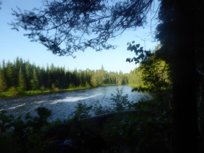
Looking downstream from my hammock.
My camera must have had fogged lenses because all of the pictures I took that evening have a slightly out of focus look to them. This is just downstream of the rapids and both Darrel and I knew this would be an excellent walleye spot unfortunately the walleye did not know about it. After a good night’s sleep and breakfast we got on the water. For those who have paddled the Cache River this is nothing like the Cache River. The Cache is shallow with no river bank and little current. The Wawiag is deep an there is almost always enough current that you notice it while paddling. I found several holes that were 40 foot deep. Particularly the upper part of the Wawiag is very nice. This is the only picture I took of the upper Wawiag.
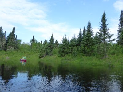
Darrel trying to get a picture of a bear.
After a diversion up Mack Creek to satisfy our entry permit requirements we were on our way. At the portage I fell head first into the river. I had gotten out and was on the bank on all 4s and my canoe was starting to move toward the rapids. I crawled down the bank to the water’s edge and reached for my canoe when the hand that was at the water’s edge slipped. So here I am facing downhill while on my knees with nothing in front of me but water. So in I went head first. I came up in chest deep water and pulled my canoe over to shore. So I unloaded the canoe while standing in waist deep water and pushed the canoe up on shore before crawling out myself. Darrel was much more graceful. The river was a little over 19 miles and we were ready to camp when we got to Kawnipi[LD1]. We took the campsite on the first island. We spent 6 nights in 3 campsites on Kawnipi then moved to Antoine for 2 more nights and then out with one night on Dore Lake. Like the trip started we finished in the rain.


