Trip Report, Quetico August 2014
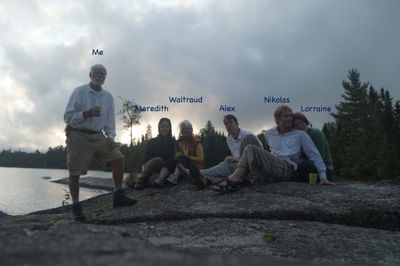
Our biggest challenge was organization and logistics. My wife Waltraud, our son Nikolas and I flew in to Thunder Bay from Zurich, Lorraine from Boston and our son Alex and girlfriend Meredith from California. Each of us had designated gear and food to bring.
Our schedule was slightly constrained by the UC Berkeley academic calendar: Instead of a more ideal 14 day trip, we limited it to 11 days and minimized the down time before and after. However, Delta Airlines and LA International almost spoiled our well laid plans by failing to forward Alex and Meredith’s luggage when they changed planes in LAX. Fortunately the luggage arrived only a half day late and our outfitter, Barry Giles at Camp Quetico, rescheduled the pickup so that we were able to put in on the 15th - in early afternoon instead of early morning.
LESSON LEARNED: If possible, ship your critical gear to the outfitter well in advance of trip.
I have a 15 minute video of the trip posted on Vimeo. https://vimeo.com/108937331
Day 1, 15. August
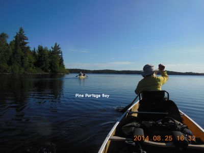
Pickup in Thunder Bay and drive to Camp Quetico at Eva Lake for final organization and equipment rental. Barry drove us (some 20 km gravel road) to Stanton Bay and we were able to put in by early afternoon under sunny skies. Stanton Bay has a special meaning for me because that’s where my wife and two sons put in on our first Quetico trip 19 years ago.
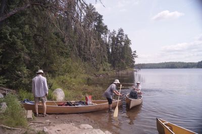
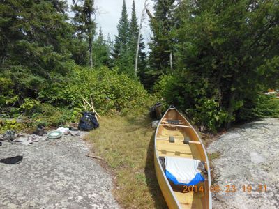
After paddling across Pickerel with several stops for swimming and for lunch, we portaged to Bisk and then on to Beg. The campsite (1EM) on the west side of the Beg-Bud rapids was just large enough for our three tents.
Day 2, 16. August
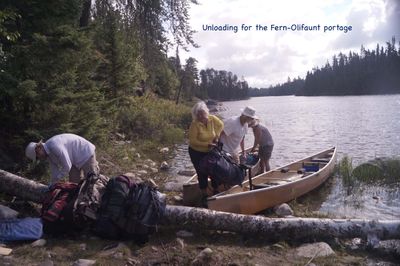
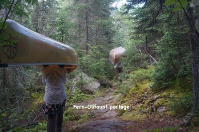
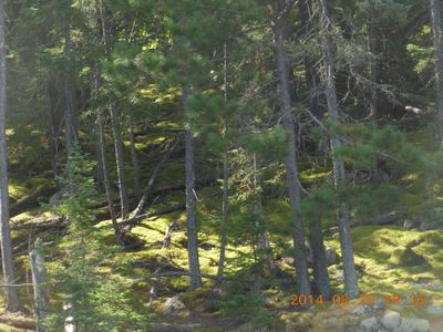
We knew that water levels in Quetico were very high, however, we fully realized how high only when we saw the Beg-Bud rapids. Instead of a simple little flow-over preceded and followed by some fast water, we got to rush down some 50 meters of really fast water. (In ’95 my 12-year old son and I were able to paddle up this rapid). After the Bud-Fern portage we just rode down the current and entered Fern Lake. In other years we’ve walked in the Pickerel River dragging our canoes. We stopped for lunch and a swim at 18B on Olifaunt. A great island campsite with terrific granite plate for relaxing and swimming, but the island is really too small to be a true campsite and I’d recommend against using it unless you really can’t reach another site. On Sturgeon, we camped at campsite 645, a really terrific roomy site.
Day 3, 17. August
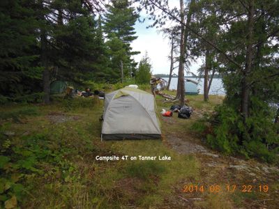
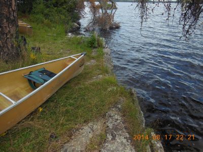
On the way down Sturgeon, we stopped at campsite KP for a swim and a chat with an older couple camping there. I always call that sandy peninsula Waikiki Beach because of the sandy beaches and from a certain distance away, the pines appear to be palms. Under threatening skies and increasing wind, we stopped for lunch at campsite EA near the end of Sturgeon Lake. I didn’t rate this site because I don’t think it ought to be used as a campsite. The island is too small for proper sanitation and it is seriously overused and trashy. Going down the Maligne River it was quickly pretty clear why the outfitter told us to not even try an upriver route – it was really roaring. We spent the night at 4T on Tanner Lake, a nice roomy campsite with soft grass on which to pitch tents. The take-out/put-in was extremely easy (I even made a video of that.). How it would be if the water level were lower and closer to normal, that is another question.
Day 4, 18. August
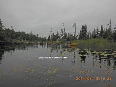
After crossing Tanner we entered the creek to get to the “Eat ‘em up” portage to Andrews Creek. After thrashing about in the creek where, according to older maps, the portage begins, we looked on the park map and found out we should have looked further east along the lake shore. I’d been telling the others that the name “Eat ‘em up” represents an exaggeration of the portage’s difficulty. I had to eat my words. There was a lot more deep mud and more slippery logs than I remembered from 10 years earlier and the trail was badly grown over so we were always stumbling on roots and rocks. By this time it was beginning to sink in on me that the general condition of the portage trails was not what it used to be. I’ve read that the visitor days to Quetico have been steadily decreasing and park service is having trouble funding maintenance. That they are spending less on portage maintenance, I can easily believe.
After the trials and tribulations of the “Eat ‘em up”, we were rewarded with a most pleasant paddle down the half km of Andrews Creek followed by an easy 1.5 km up the Darkwater River. The “easy” ended with the first portage near Wicksteed Creek and the portages just seemed to get worse as we got closer to Darkwater Lake. The main difficulty was that the take-outs and put-ins were so awkward.
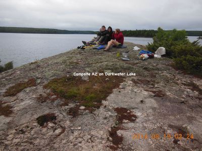
The weather was threatening as we entered Darkwater Lake and there was apprehension that we might be unloading and pitching tents in the rain. Fortunately we arrived at campsite AZ on Darkwater and got our tents up before the rain came. Ended up pitching our big tarp as a cooking shelter. Luckily the rain stopped before dinner and we were able to dine on the rocky point and enjoy the panoramic view over Darkwater Lake.
Day 5, 19. August
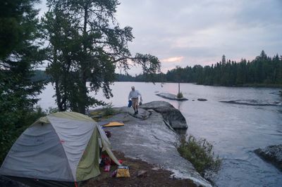
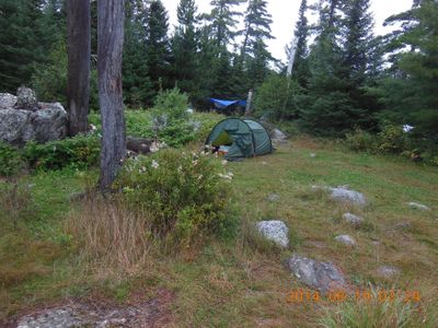
Under a gray sky we portaged to Brent Lake and paddled to its east end where we camped at site LD, a small island that has really been worn out by overuse. Had I realized how worn out it was, I would have tried to avoid using the site. With rain threatening again, we didn’t dare pitch tents lower down on the west side, using instead some tent sites scattered along the ridge along the east side. Campsite LD has a really nice landing and I couldn’t resist shooting a video of Alex and Meredith unloading their canoe.
Day 6, 20. August
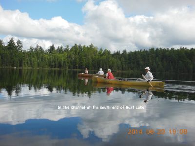
After two short portages we found ourselves in McIntyre Lake from where we took the P445 into Paulene followed by the P235 into the scenic channels (actually the Darkwater River) leading to Burt Lake. The day turned sunny with cumulus clouds and everyone was upbeat going into Burt.
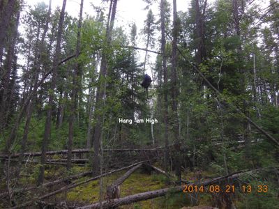
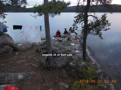
I had planned the trip around camping on Burt at campsite UE (at the southern tip of Burt’s big island). Twice on past trips we had camped there and I had memories of a terrific campsite. And it is a terrific site if one is not too picky about tent pads. Alex made a record throw over a bent pine to hang the food pack.
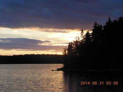
The weather started closing in and we had a bit of rain, but afterwards we were able to dine on the long rocky point. There was some clearing in the west and soon the sun streamed in to us. A magnificent Canadian sunset marked the end of another great Quetico day.
Day 7, 21. August
Under a gray sky we headed south across Burt for the portage to Marj. Beautiful Marj Lake with no rated campsites – at least not then. For years I’ve wanted to paddle all over Marj Lake, but every time we end up with some kind of time limitation. This day was no exception – A P300 and a P210 to Joyce with no good campsites and then a 590 and a 920 to Kahshahpiwi. At the end of the P920 we met an interesting solo canoeist who had been out for weeks and not surprisingly, was very eager to have a long conversation with us. Even more surprising was that he had bicycled to Ely from his home in Michigan and after the canoe trip (he had another week or so to go), he would bicycle back to Michigan.
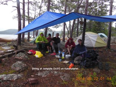
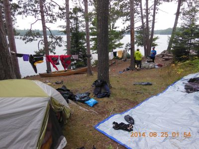
On Kahshahpiwi the gray sky turned more threatening and we had to find a campsite in a hurry. We found one on an island too small to actually afford a campsite – I think it was campsite 143. We got our tents pitched in the dry but had to cook and dine under our big tarp.
Day 8, 22. August
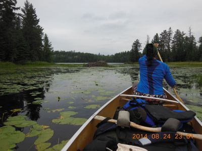
The day turned pleasant as we headed down Kahshahpiwi Creek, through Keefer and Sark and then lunch and a swim on a big granite slab on the point of a small peninsula on Cairn. I still don’t know if we got the right portage out of Heronshaw, but we sure did have trouble in the grassy swamp on the east end – very deep mud holes – I went in knee deep while carrying a canoe and had a scary fall.
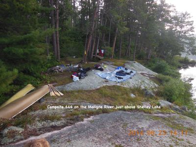
We camped at 646 on an island between the two branches of the Maligne River that flow into Shelley Lake. Campsite 646 was buggy and did not have very clear water. The site has 3 good tent pads and a big granite slab for dining and socializing. It's big advantage on that day though was that it was available when we needed a campsite very badly.
Day 9, 23. August
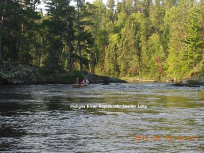
Most maps show a portage around the rapids where the Maligne flows into Shelley but we were able to run the rapids as we have on every other trip. The day turned pleasant with brilliant blue skies as we headed west on Shelley. However, our buoyant spirits went south when I missed the channel leading to “Have a Smoke” and caused us to portage twice instead of once. The first portage was okay but the second one (#5242) looked like it hadn’t been used for years. We bushwhacked and sweated for what seemed like hours before we got through to Keats.
I’d never been to McDougall Lake before so I decided we’d suffer an extra portage to get to Chatterton. After a pleasant lunch and swim at the south end of the nice little McDougall-Chatterton portage, we went on through and saw that the channel to the west of the big island was all water. That was the first time I’ve been able to paddle through instead of portaging.
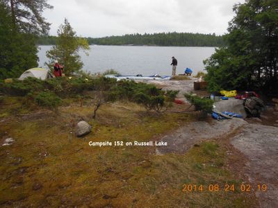
I guess I still hadn’t fully comprehended all the effects that the high water levels would have because I was surprised that the beach at the west end of the Chatterton-Russell portage was completely submerged. On Russell our usual campsite, 13J or 13M were occupied so we had to look elsewhere. Again I was baffled by the water levels – the great big granite slabs on the south side of the big horseshoe shaped island were all under water. We started getting concerned about finding a site because it was late and the weather was deteriorating again.
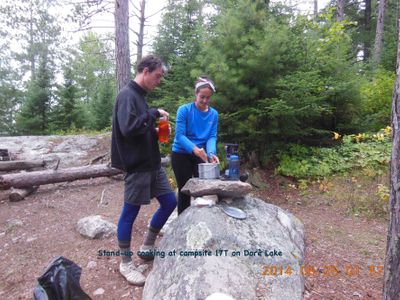
We ended up on campsite 152 and had zero regrets – this baby has it all! Good landing, 5 good tent pads, big granite slab, etc. And it was one of the two sites on our trip that had stand up cooking!
Day 10, 24. August
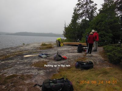
We awoke to a leaden sky and just as we got the canoes loaded, gigantic rain drops began falling. Fortunately this stopped by the time we got to channel leading out of Russell. The Russell Rapids were perfectly runnable as they have been on every one of my Quetico trips, it’s just that this time they were carrying a lot more water. I don’t know if we could have paddled up them as we usually do.
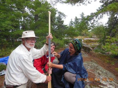
By the time we got into the big eastern basin of Sturgeon Lake, the wind had picked up – luckily out of the south so we quickly arrived at Blueberry Island for a rest because we had a sick member of the party. While jockeying around looking for a good landing spot, my son Alex broke his wooden paddle – not on a rock, but simply by paddling very vigorously against the wind. Fortunately one of our rucksacks was on its last trip before retirement so out of it I pulled the aluminum stays and used these as splints to be bandaged to the paddle using duck tape and 1/8” cordage. Being the one who made the decision not to carry a spare paddle, I thought it only fair that I take the splinted paddle. It turned out to not be such a big sacrifice because the splinted paddle took on a moderate curvature and was quite ergonomic.
It was mid-afternoon by the time Lorraine was feeling well enough to travel. We could have stayed on Blueberry Island but we needed a campsite within striking distance of Batchewaung for our take out on Nym on the 24th. We decided to try for Dore Lake and hope that 17T, where we’d stayed in 2008, would be vacant. Unfortunately, the need to reach Dore on time did not allow for a leisurely passage through the rice fields of the northern end of Sturgeon and the swamps of the Deux Rivières. Campsite 17T turned out to be empty so we got to enjoy the second stand up cook spot on our trip.
Day 11, 25. August
We awoke to a glorious morning with clear skies. Only two portages and a run up Pickerel Lake and we’d be at our final camp on Batchewaung Bay. We did the Pine Portage and then crossed the bay to take the shortcut portage, #5102 to Pickerel.
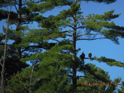
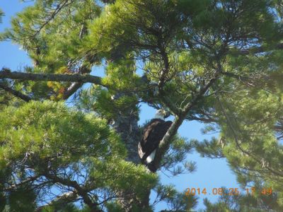
On Pickerel Lake we had the luck to observe two eagles enjoying the sunny day in a big white pine.
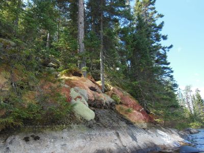
Cruising through Pickerel Narrows we came across a north facing shoreline with a most magnificent collection of mosses and lichens attached to the rock. Couldn’t shoot enough photos.
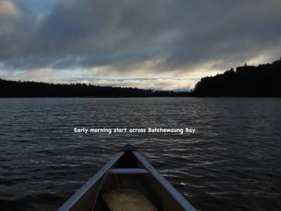
The pleasant day got cut short as we neared the west end of Pickerel – in other words the wind got so strong that we had to take shelter and wait. Fortunately, after an hour the wind abated enough that we could make it though to Batchewaung Bay where we camped at campsite TC. After making camp, the wind picked up again and we worried about making our pickup at Nym Lake the next day. Our strategy for the next day was to start very early in the hope of getting across Batchewaung before the wind came up.
Day 12, 26. August
After getting up and breaking camp before first light, we had to wait more than an hour for the wind to let up enough to safely cross Batchewaung Bay. The scare we had had in Little Batchewaung 19 years earlier was still on my mind but Little Batchewaung behaved itself this time. The wind picked up quite a bit when we were part way across Batchewaung Lake and the landing at the south end of the Batchewaung Portage was a little wild. Interestingly enough, Nym Lake was pretty tame and we were quickly across and hours ahead of our scheduled pickup.
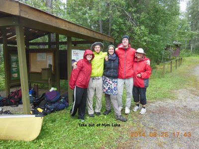
Barry Giles took our call for early pickup and sent his father with van and trailer. After settling our account, his father drove us back to Thunder Bay where we stayed overnight at the Best Western Plus and then caught flights home the next day.
Gear Notes:
1. We carry two JetBoil stoves and never count on cooking over a campfire. For cooking, we boil the water in the insulated JetBoil pot and rehydrate/cook in a larger 3 – 4 liter pot. Coffee fanatics that we are, we bring our own ground coffee along from Europe and prepare the brew in the JetBoil French press. We’ve noted that coffee tastes better if we run the water through our water filter before boiling. Our next step in the quest for better coffee is to bring coffee beans and a hand grinder.
2. Our packs are inexpensive 80 liter rucksacks. These are much smaller than the classic Duluth packs and it means we have to double carry and we take longer to do a portage. It also means we don’t have the backbreaking task of pulling a loaded Duluth out of a canoe and all members of the party are able to carry. Double carrying also means that on every portage we get to enjoy a pleasant jaunt through the woods without carrying anything.
3. We line the packs with 3 mil, 42 gallon contractor clean-up bags and we carry reserve bags. Using this method, rain is no longer the big deal it once was.
4. Our water purifier is a First Need XL with cartridge filter. We bought this after getting tired of our Katydyn ceramic filter clogging after a few days. We thought that the First Need might not filter as well as the Katydyn, but we were pleasantly surprised – the First Need actually removed the color from tannin laden lake water – something the Katydyn never could.
5. My maps (better said maplets) are printed double sided on 8 ½ x 11 inch waterproof paper and I carry them in a see-through case. I have all the 50,000 scale Canadian topos for Quetico seamlessly connected and overlaid with campsites and portages. For the intended route, I make screen grabs covering roughly 7 x 9 km rectangles and save them as jpegs, which I can print borderless on the waterproof paper. The scale of the printed maplets, around 1:32,000, lets this 70 year old read the map while it lays in my lap and without resorting to special glasses. In case of complex lakes, I select the rectangles so that I won’t have to study two or more maps at one time. As a backup or in case of a route change, I carry a park service portage map of the entire park.
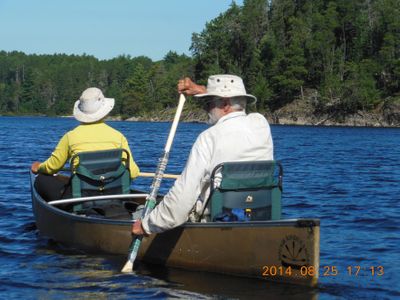
6. My wife and I use GCI folding canoe seats. They give us lots of comfort (and paddling power) that we began to miss as we got into our late 60's and early 70's. On the subject of comfort, one of the many things that we really like about canoeing in western Ontario is that, unlike in Algonquin and Killarney, all the outfitters put nice thick cushy pads on the carrying yokes. You'd think that with some of the monster portages in those eastern parks, the eastern outfitters would catch on.
7. On many portages, I really regretted not having at least a saw -we encountered that many down trees. Looking back on the many portages that were nearly grown over with brush, I might even consider taking some kind of brush axe.


