Paddle Planner Forum
»
General
»
Trip Planning
»
Holy WOW.....Map Exporting is THE BOMB
 Thanks: 95 times
Was thanked: 159 time(s) in 140 post(s)
|
Glad you like it! I use it myself on my trips. I also just added a feature that someone requested. You can now print the details (including detailed ratings and photos) for the campsites shown on the exported map. There are a few options to show or hide stuff as well.
|
|
|
|
|
|
 Thanks: 10 times
Was thanked: 31 time(s) in 22 post(s)
|
Definitely interested! How does one go about doing this?
|
|
|
|
|
|
Thanks: 95 times
Was thanked: 159 time(s) in 140 post(s)
|
Originally Posted by: TuscaroraBorealis  Definitely interested! How does one go about doing this? First turn on/off the layers and background that you want. Get the map approximately at the zoom and location that you want (you can adjust this slightly later, so exactness isn't important). Then use the "Export to Image" button on the left - 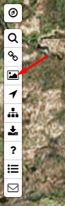
Follow the instructions on the next screen. While I don't advise using it to navigate by, I find it useful on my trips. I especially like it for the Quetico since most campsites aren't marked on other maps.
|
 4 users thanked Ben Strege for this useful post.
|
|
|
|
 Was thanked: 1 time(s) in 1 post(s)
|
Yeah, just discovered the export tool yesterday - just aweosme. My roommate and I downloaded the map and overlayed it directly to Google Earth and you can map out your route and see elevation changes..amongst other things. It makes planning a real treat.
|
|
|
|
|
|
| Users browsing this topic |
|
Guest
|
Paddle Planner Forum
»
General
»
Trip Planning
»
Holy WOW.....Map Exporting is THE BOMB
Forum Jump
You cannot post new topics in this forum.
You cannot reply to topics in this forum.
You cannot delete your posts in this forum.
You cannot edit your posts in this forum.
You cannot create polls in this forum.
You cannot vote in polls in this forum.


