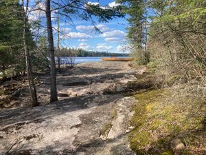
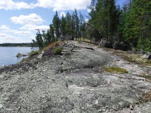
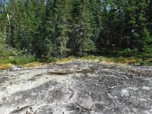
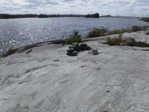
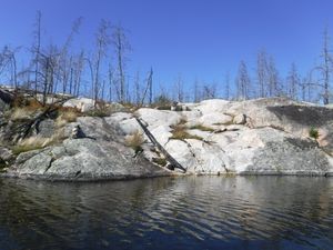
Longest WCPP portage at north end looking south
51.27254/-95.14998
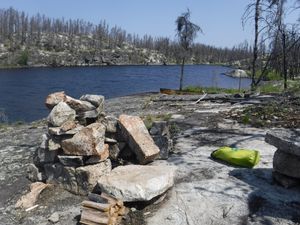
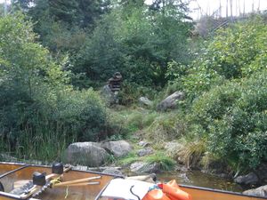
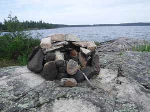
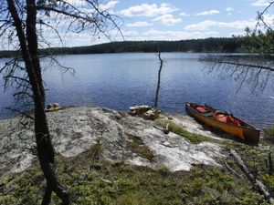
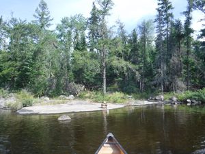
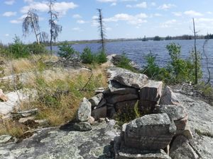
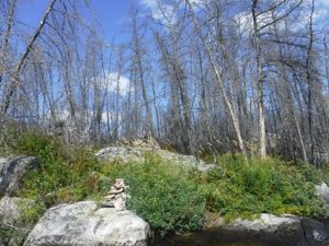
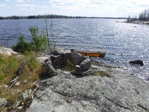
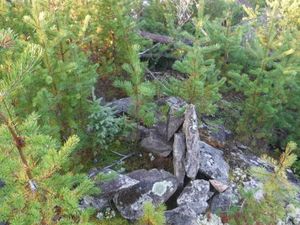
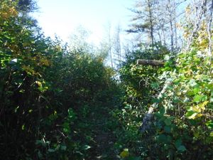
South entrance to 375m portage marked by rock cairn
50.96589/-95.04161
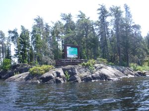
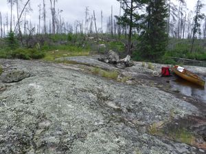
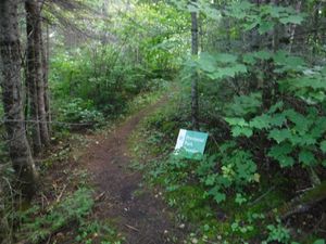
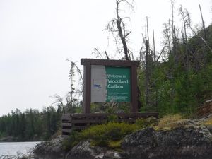
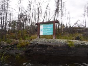
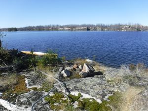
WCPP sign marking old park boundary
50.67626/-94.47607
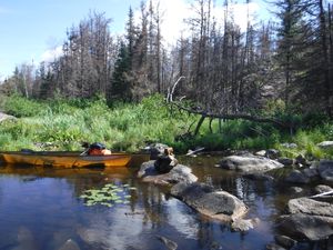
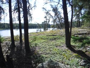
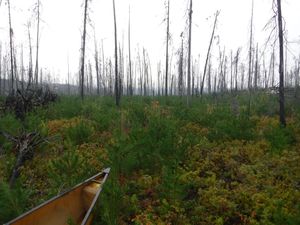
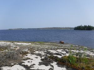
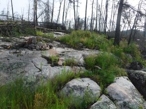
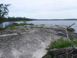
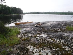
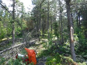
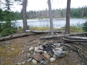
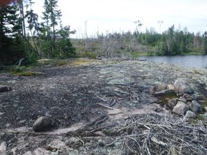
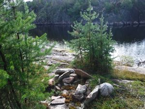
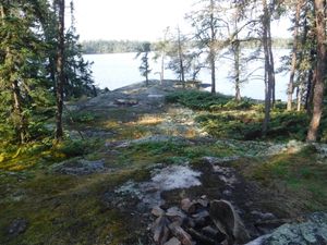
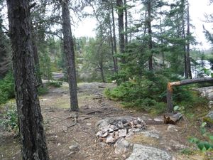
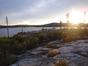
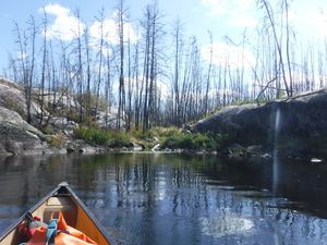
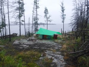
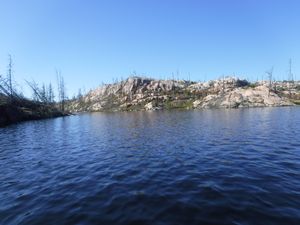
KE campsite before 2021 fire looking west
6/12/2021, 50.80601/-94.77698
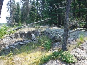
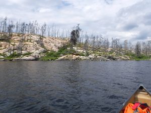
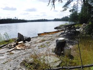
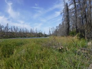
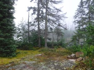
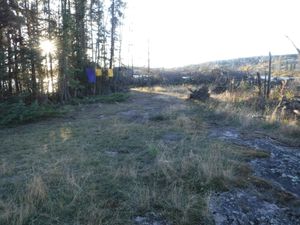
Washout from 2022 early spring flooding, looking north
5/27/2022, 50.75769/-94.47111
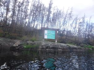
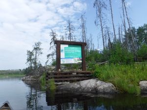
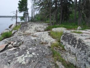
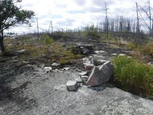
WCPP sign surviving 2021 fire
7/23/2022, 50.68702/-94.84905
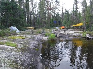
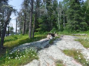
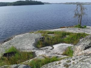
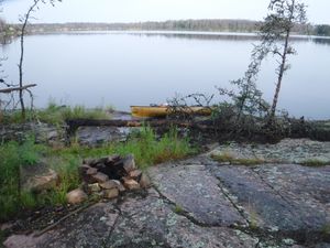
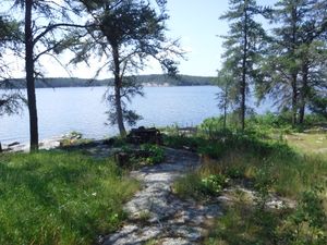
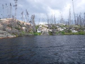
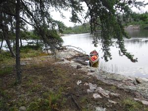
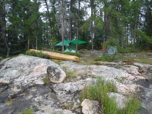
Beautiful Gammon Campsite
7/28/2022, 51.01039/-94.73898

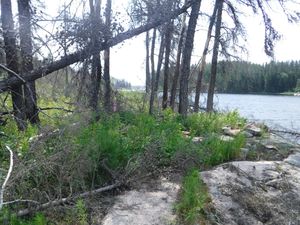
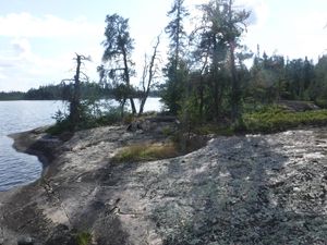
Beautiful Gammon Campsite
7/28/2022, 51.01039/-94.73898
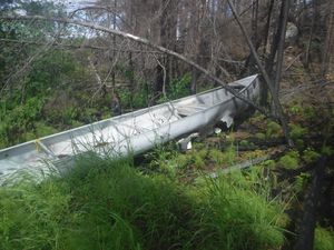
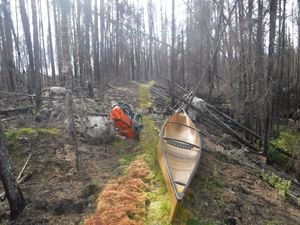
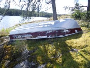
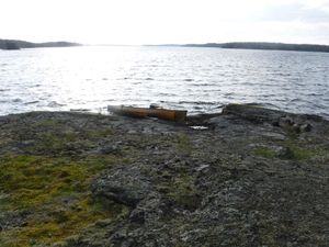
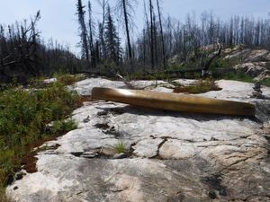
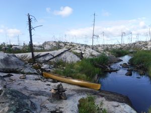
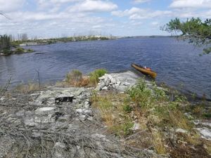
Melted canoe along portage trail
7/28/2022, 51.06147/-94.52311
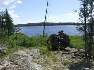
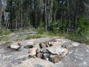
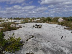
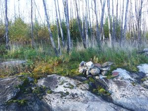
Cairn marking south entrance for portage
7/29/2022, 51.04379/-94.44166
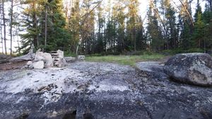
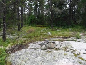
Campsite that survived the 2021 fire
7/29/2022, 51.02667/-94.40536
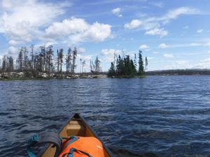
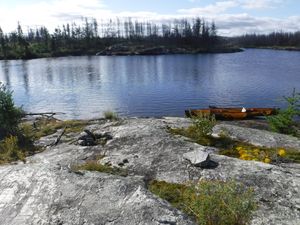
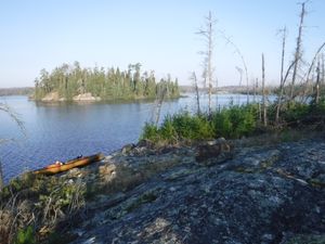
Island campsite
7/29/2022, 51.02819/-94.57839
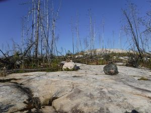
North entrance to portage that was not burned by 2021 fire
7/29/2022, 51.0337/-94.41963
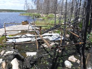
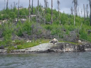
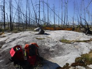
Old wild rice harvesting machine exposed by 2021 Fire
7/29/2022, 51.03924/-94.37415
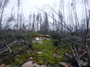
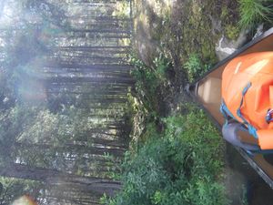
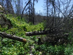
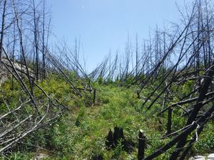
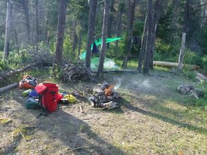
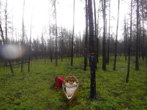
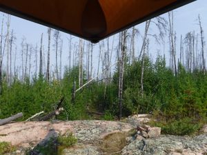
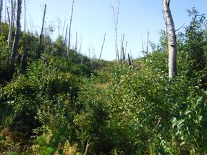
Green portage trial through burnt forest
9/8/2022, 51.33623/-94.23088

Green portage trial through burnt forest
9/8/2022, 51.33623/-94.23088
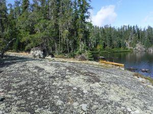
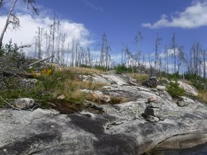
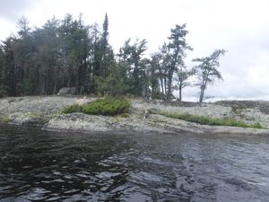
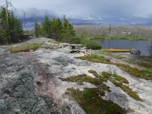
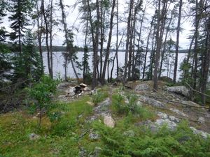
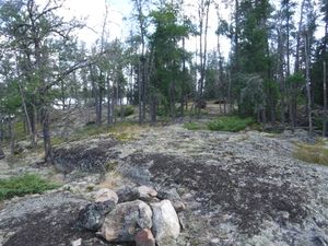
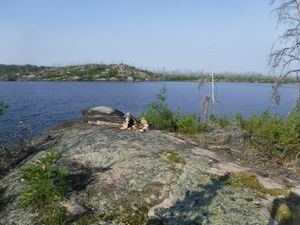
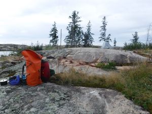
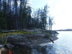
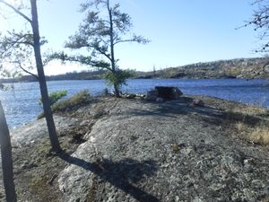
Rock peninsula campsite
9/9/2022, 51.29899/-94.29934
Start of portage trail from the west side
9/9/2022, 51.29993/-94.31017
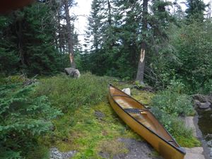
Beautiful hardly used campsite on Young Lake
9/10/2022, 51.26371/-94.42429
Boat cache for fly-in fishing
9/10/2022, 51.26371/-94.42429
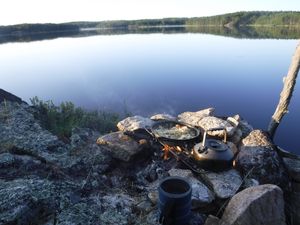
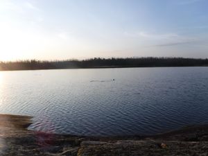
Campfire fire pit down by lake looking east
9/10/2022, 51.25223/-94.29706
Knox Lake island campsite looking east
9/11/2022, 51.16875/-94.42998
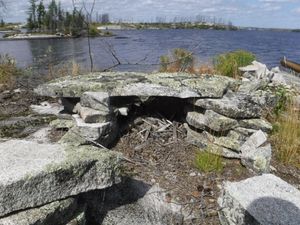
Burned out campsite with good fire pit
5/26/2023, 50.84643/-94.65551
Portage start at Praire Lake looking east
6/24/2023, 51.06011/-94.5297
Indian House Portage on NE side_looking north
6/25/2023, 51.1068/-94.43127
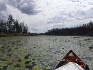
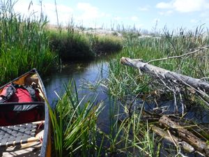
Thick lily pads
8/13/2023, 51.11726/-94.952
South start of 600m portage on Irvine Loop
8/16/2023, 51.11666/-94.76026
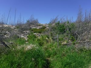
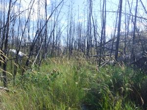
Ridge top fire damage looking east
8/30/2023, 50.73559/-94.69894
Standing dead on east side portage entrance
8/30/2023, 50.7295/-94.67659
Dragon campsite
8/31/2023, 50.72351/-94.6108
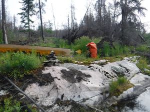
Rock cairn marking north entrance for Paull portage
8/31/2023, 50.76318/-94.65101
Beautiful Jigsaw campsite from the water looking north
6/9/2024, 50.87773/-94.7862

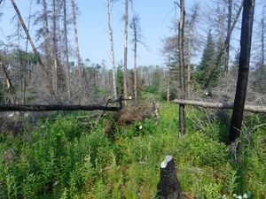
Burnt portage trail looking west
6/9/2024, 50.81755/-94.80265
Cut burnt trees looking south
6/9/2024, 50.84953/-94.77701
Jigsaw campite looking east
6/9/2024, 50.87773/-94.7862
Pushed over standing dead on Welkin portage, looking south
6/9/2024, 50.83834/-94.81868
south entrance of Welkin portage looking north
6/9/2024, 50.83776/-94.81876
Burned portage east of Musclow Lake
7/11/2024, 51.4173/-94.90334
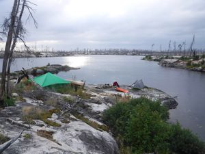
Exposed island campsite on Musclow Lake
7/11/2024, 51.39674/-94.92349
Island granite beach campsite on Musclow
7/11/2024, 51.40008/-94.91737
Usable campsite on Musclow River
7/11/2024, 51.34277/-94.91215
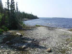
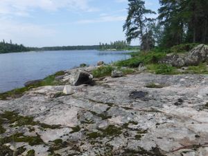
Artery Lake campsite looking north
7/12/2024, 51.33733/-95.12581
Burned campsite on Artery
7/12/2024, 51.33687/-95.11686
Burned campsite on Barclay
7/12/2024, 51.32553/-94.92759
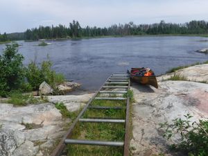
Marine roller railway looking east on the Bloodvein River
7/12/2024, 51.3382/-95.1385
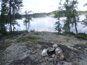
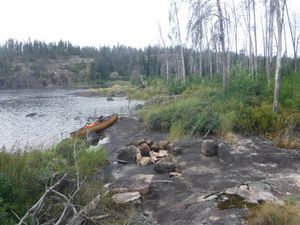
Peninsula campsite looking north
7/12/2024, 51.3373/-95.12272
Burned 1500m portage looking south approximately halfway
7/13/2024, 51.23978/-95.14649
Burned Artery campsite looking northeast
7/13/2024, 51.30191/-95.12674
Burned Artery campsite looking west
7/13/2024, 51.33156/-95.1236
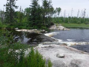
Beautiful portage around small rapids into WCPP
7/14/2024, 51.07441/-95.15396
Campsite on Caroll Lake looking west
7/14/2024, 51.15505/-95.12537
Caroll Lake campsite looking north
7/14/2024, 51.15212/-95.13081
Caroll Lake campsite well built fire ring
7/14/2024, 51.15212/-95.13081
Caroll Lake island campsite looking north
7/14/2024, 51.1152/-95.1248
Caroll Lake large island campsite looking south
7/14/2024, 51.11045/-95.12962
Craven campsite looking north
7/14/2024, 51.18443/-95.14728

Short portage around small rapids into WCPP
7/14/2024, 51.07441/-95.15396

Short pull over at Park Entrance
7/14/2024, 51.07441/-95.15396
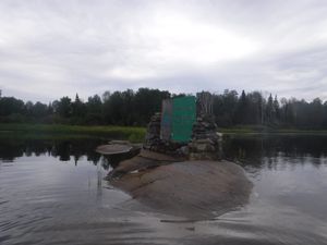
WCPP Sign at Obukowin Lake Entrance
7/14/2024, 51.07543/-95.1543
WCPP Sign on Gammon River
7/14/2024, 51.1206/-95.15353
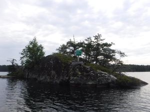
WCPP sign on small island
7/14/2024, 51.18795/-95.15272

WCPP welcome sign looking east
7/14/2024, 51.07581/-95.15353
Beautiful Caroll Lake campsite looking east
7/15/2024, 51.08219/-95.02996
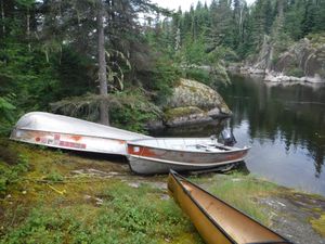
Cached fishing boats on Rostoul Lake 100m SW of Portage trail
7/15/2024, 50.97702/-94.78738
Caroll Lake campsite looking west
7/15/2024, 51.08177/-95.03076
North end start of portage looking south
7/15/2024, 50.98201/-94.7863
Campsite on Gammon Lake looking west
7/16/2024, 51.00448/-94.7313
Constellaion Lake campsite looking north
7/16/2024, 51.05256/-94.7376
Royd Lake campsite looking west
7/16/2024, 51.04022/-94.76306
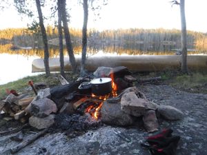
campfire breakfast looking southeast
7/17/2024, 51.06775/-94.54746
Joey Lake 5 star campsite looking southwest
7/17/2024, 51.05054/-94.59995
nice campsite on small lake looking southeast
7/17/2024, 51.06775/-94.54746
Royd Creek campsite looking north
7/17/2024, 51.06055/-94.68354

Royd Creek campsite looking southeast
7/17/2024, 51.06055/-94.68354
West entrance to the Joey Lake 475 m portage
7/17/2024, 51.06062/-94.58609
North portage entrance on rock outcrop
7/18/2024, 51.04713/-94.43981
Fire ring at Kilburn Lake campsite
8/2/2024, 50.73702/-94.47791
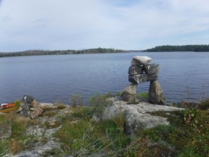
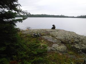
Beautiful rock cairn on small Kilburn Lake island
8/3/2024, 50.68077/-94.47543
Fishing lodge boat cache at start of portage
8/3/2024, 50.59813/-94.45646
Nice shore lunch campsite used by outpost fishing lodge on Rowdy Lake
8/3/2024, 50.59065/-94.43891
Small campsite on Kilburn looking south
8/3/2024, 50.7136/-94.48123
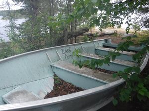
Strange boat cache on a nice campsite
8/3/2024, 50.61326/-94.45813
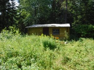
Trapline cabin on Sydney Lake
8/3/2024, 50.59877/-94.46663
Unmarked Sydney Lake campsite on exposed rock beach
8/3/2024, 50.64522/-94.43779
WCPP sign on portage trail
8/3/2024, 50.56394/-94.42114
Beautiful out of the way campsite
8/4/2024, 50.70998/-94.54406
Nice 5 star campsite on Kilburn Lake looking north
8/4/2024, 50.69059/-94.49197
nice but exposed campsite on Kilburn Lake
8/4/2024, 50.7006/-94.51146
Rarely used campsite looking west
8/4/2024, 50.71057/-94.53227
Small but beautiful campsite on south Kilburn Lake
8/4/2024, 50.69059/-94.49197
Small island campsite looking west
8/4/2024, 50.72373/-94.53092
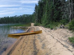
Beautiful sand beach at west portage entrance, looking north
8/5/2024, 50.74093/-94.51666
New west entrance for portage trail found on north side of bay, looking west
8/5/2024, 50.71795/-94.57592
not used campsite looking east
8/23/2024, 50.97483/-95.00553
Not used campsite looking west
8/23/2024, 50.97483/-95.00553
old fire ring at unused campsite looking south
8/23/2024, 50.98821/-94.98373
Portage trail campsite looking southwest
8/23/2024, 50.96559/-94.9769

Reclaimed by nature and unusable campsite looking west
8/23/2024, 50.96965/-95.03932
5 star unmarked island campsite looking east
8/24/2024, 50.97916/-95.12692
Beautiful campsite on Broken Arrow Lake looking west
8/24/2024, 50.95639/-95.0886
Beautiful unmarked island campsite on Crystal Lake looking east
8/24/2024, 50.97916/-95.12692
Broken arrow campsite looking south
8/24/2024, 50.95554/-95.09815
East end Crystal Lake campsite looking southeast
8/24/2024, 50.98019/-95.10919
Fading WCPP sign on south side looking east
8/24/2024, 50.9791/-95.13542
Old unused campsite looking east
8/24/2024, 50.96938/-95.09294
River otters swimming by campsite looking north
8/24/2024, 50.95639/-95.0886
Standing dead and re-growth trees on Crystal Lake Portage looking north
8/24/2024, 50.9744/-95.1018
5 star campsite on Crystal Lake looking northeast
8/25/2024, 50.97855/-95.12999
5 star campsite on Crystal Lake looking southwest
8/25/2024, 50.97855/-95.12999
Burned landscape and campsite looking west
8/25/2024, 50.86399/-95.07273
Decent campsite looking south
8/25/2024, 50.96655/-95.09928
South entrance to portage looking south
8/25/2024, 50.87163/-95.06994
Burned down to the rock portage looking west
8/26/2024, 50.86161/-95.08889

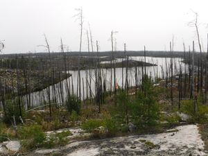
hill top view of Jester Lake showing fire damage looking west
8/26/2024, 50.83175/-95.12229
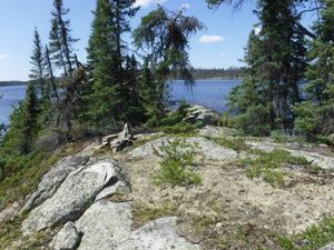
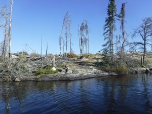
Island campsite that survived 2021 fire looking south
8/26/2024, 50.85946/-95.11635
Burned up campsite on Garner River looking southeast
8/27/2024, 50.86396/-95.10233

HD campsite from on top of ridge looking west
8/27/2024, 50.84936/-95.03328
HD campsite looking north
8/27/2024, 50.84936/-95.03645
HD campsite looking west
8/27/2024, 50.84947/-95.0344
5 star unmapped campsite on Irregular Lake looking southwest
8/28/2024, 50.77195/-94.96552
Close of fire pit on Mather Lake looking east
8/28/2024, 50.84146/-95.01038
Close up of dutch oven on Mather Lake looking north
8/28/2024, 50.83382/-95.00627
Fire ring campsite on Mather Lake looking north
8/28/2024, 50.83382/-95.00627
Mather Lake campsite looking north
8/28/2024, 50.83545/-95.01091
North entrance marked with cairn looking south
8/28/2024, 50.85498/-95.03809
North entrance marked with cairns looking south
8/28/2024, 50.85773/-95.03746
Over grown portage portage looking south
8/28/2024, 50.87342/-95.02195
Overgrown Irregular portage looking south
8/28/2024, 50.77965/-94.96732
Removing dead fall from Creek
8/28/2024, 50.84782/-95.03466
South entrance to Irregular portage looking north
8/28/2024, 50.77913/-94.96707
South entrance to Irregular portage looking south
8/28/2024, 50.7803/-94.96763
Unused campsite on Mather Lake looking south
8/28/2024, 50.84146/-95.01038
Well constructed fire rings on Mather campsite looking south
8/28/2024, 50.83382/-95.00627
Wide open Mather Lake campsite looking southwest
8/28/2024, 50.83545/-95.01091
M7 campsite after clean-up looking north
8/29/2024, 50.78006/-94.93323
M7 campsite before clean-up looking south
8/29/2024, 50.78006/-94.93323
WCPP welcome sign looking northwest
8/31/2024, 50.68773/-94.84793
Burned out campsite on Burntrock
9/2/2024, 50.81796/-94.63268
fire ring being taken over by nature
9/2/2024, 50.8216/-94.63844

Pre-fire campsite being reclaimed by nature
9/2/2024, 50.8216/-94.63844
Burned but usable campsite on Optic Lake
9/3/2024, 50.917/-94.5235
Burned up campsite on Optic
9/3/2024, 50.91732/-94.51948
Mexican Hat burned campsite looking north
9/26/2024, 50.86348/-94.66206
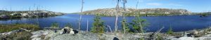
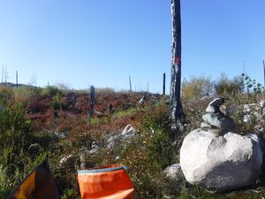
panoramic view of campsite GZ
9/26/2024, 50.85975/-94.70455
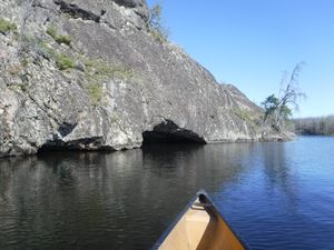
Aegean water cave entrance looking north
9/27/2024, 50.82079/-94.78605
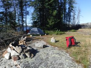
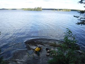
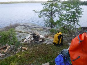
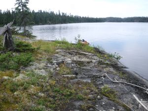
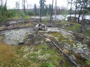
Beautiful KE campsite post 2021 fire looking southwest
9/27/2024, 50.80601/-94.77698
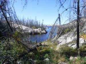
Cleaned up western entrance to Aegean portage looking west
9/27/2024, 50.80825/-94.79225
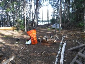
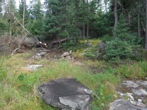
KE campsite cleaned-up after 2021 fire looking west
9/27/2024, 50.80601/-94.77698
KE campsite west side fire ring looking west
9/27/2024, 50.80601/-94.77698
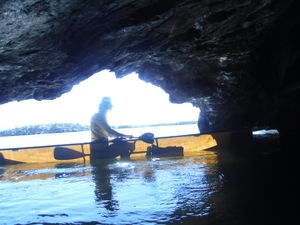
looking out from Aegean Lake water cave at solo canoer
9/27/2024, 50.82079/-94.78605
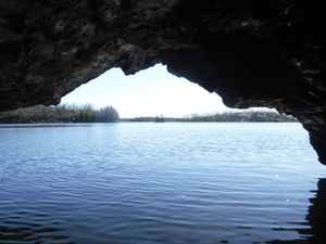
Looking out from Aegean water cave
9/27/2024, 50.82079/-94.78605
More rock cairns marking eastern start of Aegean Portage, looking west
9/27/2024, 50.80771/-94.79067
Tree cut out of the way looking southwest
9/27/2024, 50.80368/-94.78639
Unused and burned up Aegean campsite, looking west
9/27/2024, 50.81234/-94.77889
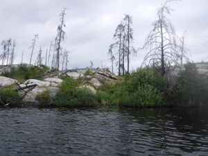
Western Aegean Lake shoreline burned right down to bare rock
9/27/2024, 50.81608/-94.78746
campfire cooking at MD campsite looking southeast
9/28/2024, 50.77575/-94.56506
North Aegean portage entrance marked with rock cairn and orange flagging
9/28/2024, 50.79624/-94.75379
South entrance of Aegean portage looking north
9/28/2024, 50.79422/-94.75427
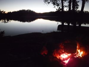
sunset campfire cooking looking east from campsite MD
9/28/2024, 50.77575/-94.56506

Veiw of MD campsite from water looking northwest
9/28/2024, 50.77575/-94.56506

Beautiful sunrise on Mexican Hat Lake
5/23/2025, 50.86294/-94.61693

Cleared portage trail looking east
5/23/2025, 50.84845/-94.59129

Cleared portage trail to Mexican Hat
5/23/2025, 50.86197/-94.61362

Rapids along portage looking upstream
5/23/2025, 50.85989/-94.60919

beaver pond in middle of portage looking west
5/25/2025, 50.75733/-94.64419

Brushed/cleaned out portage trail
5/25/2025, 50.7986/-94.5984

new growth covering up tent spots at campsite KZ looking north
5/25/2025, 50.7965/-94.59657

not used campsite KZ looking south
5/25/2025, 50.7965/-94.59657

Many downed trees in this creek
7/16/2025, 51.46147/-94.53516

Mimi Lake north entrance into WCPP
7/16/2025, 51.50051/-94.53254

Missing 800m portage
7/16/2025, 51.46545/-94.54864

Old campsite on Mimi-Burntwood route
7/16/2025, 51.48512/-94.54808

South entrance to 700m portage to Mimi Lake
7/16/2025, 51.49589/-94.53177

Swimming Moose on Mimi-Burntwood route WCPP
7/16/2025, 51.47152/-94.54795

Unmarked campsite on north side of Burntwood Lake
7/16/2025, 51.42691/-94.5022

185m Portage entrance on Burntwood Lake side
7/17/2025, 51.40867/-94.48204

Bigshell beach looking south
7/17/2025, 51.38301/-94.40016

Bigshell dock looking south
7/17/2025, 51.3819/-94.40407

Bigshell peninsula campsite looking southwest
7/17/2025, 51.37479/-94.40759

Burned 3 star campsite on Burntwood Lake looking west
7/17/2025, 51.40796/-94.49118

Burned Burntwood Lake campsite looking west
7/17/2025, 51.40796/-94.49118

Campsite C looking southeast
7/17/2025, 51.40217/-94.44827

Glacial erratic boulder fire pit looking west
7/17/2025, 51.37479/-94.40759

Grassy campsite looking west
7/17/2025, 51.37479/-94.40759

Portage entrance from Bigshell Lake
7/17/2025, 51.40376/-94.44815

Big bear prints
7/18/2025, 51.34349/-94.47832

Old campsite marked on Chrismar Park Map
7/18/2025, 51.35391/-94.42818

Rock garden leaving Bigshell Lake
7/18/2025, 51.36924/-94.42037

Boulder field looking upstream
7/19/2025, 51.33835/-94.54088

Campsite 1D looking north
7/20/2025, 51.34292/-94.64603

East entrance to 100m portage
7/20/2025, 51.38496/-94.58421

Many logjams on the Dutch River
7/20/2025, 51.37301/-94.63988

Mess of downed trees on the Dutch River
7/20/2025, 51.37031/-94.63807

North entrance after picture from handsaw clearing
7/20/2025, 51.33257/-94.66974

North entrance to portage before clearing
7/20/2025, 51.33154/-94.67074

Old campsite marked on Park map
7/20/2025, 51.33648/-94.66528

Very tough paddle on the Dutch River
7/20/2025, 51.36672/-94.63855

West entrance to 400m portage
7/20/2025, 51.38448/-94.59263

Campsite G looking west
7/21/2025, 51.39452/-94.54175

Campsite 1B fire pit
7/22/2025, 51.3445/-94.32462

Campsite 1B looking west
7/22/2025, 51.3445/-94.32462

Dried up Dutch river
7/22/2025, 51.38852/-94.50233

Low water year for the Sabourin Creek
7/22/2025, 51.35879/-94.37603

Muddy mess on the Dutch creek
7/22/2025, 51.38959/-94.50053

Thick underbrush along creek makes for a hard paddle
7/22/2025, 51.368/-94.38999

Where did the creek go?
7/22/2025, 51.39246/-94.51791

Where did the water go?
7/22/2025, 51.38932/-94.49825

1P campsite looking south
7/23/2025, 51.33798/-94.30375

1Y campsite looking south
7/23/2025, 51.33416/-94.30168

Campsite 3G looking southwest
7/23/2025, 51.28304/-94.32454

Beautiful sunrise at campsite 4k looking northeast
7/24/2025, 51.25838/-94.38518

Campsite 3Z looking west from the water
7/24/2025, 51.27172/-94.42034

Campsite 4K looking north
7/24/2025, 51.25838/-94.38518

Campsite 4Q looking southwest from the water
7/24/2025, 51.23724/-94.44896

Campsite 52 looking south
7/24/2025, 51.1995/-94.41963

Campsite 52 looking southwest
7/24/2025, 51.1995/-94.41963

Campsite 5P looking south
7/24/2025, 51.16617/-94.42121

Campsite 5P looking west
7/24/2025, 51.16617/-94.42121

Low water year on Knox Creek
7/24/2025, 51.25692/-94.43693

Low water year on the Knox Creek
7/24/2025, 51.21748/-94.44122

North entrance to 200m portage looking south
7/24/2025, 51.21068/-94.43513

South entrance of 200m portage looking north
7/24/2025, 51.20934/-94.43478

Upstream side of 100m portage entrance
7/24/2025, 51.22521/-94.44467

Beautiful Knox portage that is green and not burned
7/25/2025, 51.14699/-94.42879

Sandy beach on west side of Kilburn Lake Portage looking north
8/16/2025, 50.74092/-94.51011

Campsite P7 looking east
8/17/2025, 50.7246/-94.7166

Tent spot for campsite P6 looking west
8/17/2025, 50.7246/-94.7166

Campsite N1 looking west
8/18/2025, 50.7628/-94.7839

Downed trees in the Talon River
8/18/2025, 50.67824/-94.77781

Long rock garden looking upstream/north
8/18/2025, 50.733/-94.7938

Low water year on the Talon River looking upstream from south portage entrance
8/18/2025, 50.67852/-94.77694

north entrance to Talon portage looking northeast
8/18/2025, 50.68002/-94.77445

Overgrown portage trail looking southwest
8/18/2025, 50.67879/-94.77643

Waterfall in low water year looking downstream
8/18/2025, 50.67825/-94.77965

WCPP welcome sign that has fallen down looking north
8/18/2025, 50.67907/-94.81982

Burned campsite looking northwest
8/19/2025, 50.75929/-94.7875

Campsite KQ fire pit looking south on Leano Lake
8/29/2025, 50.79828/-94.4555

Beautiful unmarked campsite on Boot Jack Lake
8/30/2025, 50.78193/-94.5268

Campsite JH looking south
8/31/2025, 50.82613/-94.81894

Fire pit for campsite HT looking south
8/31/2025, 50.83619/-94.84933

Campsite J7 located on east side of island
9/1/2025, 50.83177/-94.85574

Chainsaw craving portage trail marker
9/1/2025, 50.91688/-94.8465

Cleared portage trail going down to north entrance
9/1/2025, 50.87293/-94.86212

cleared portage trail through dense re-growth jack pine: photo looking south
9/1/2025, 50.89438/-94.86191

Easy to find portage trail through new post-fire regrowth: photo looking north
9/1/2025, 50.85728/-94.85113

rock cairn marking south entrance for this portage
9/1/2025, 50.86876/-94.85784

rock cairns guiding the way along granite ridge: photo looking south
9/1/2025, 50.86054/-94.85337

Before picture of downed tree on Cyclops Creek
9/2/2025, 50.93866/-94.77995

Burned campsite EK looking southwest
9/2/2025, 50.91827/-94.8126

Cleared tree across Cyclops Creek at portage entrance
9/2/2025, 50.93652/-94.78495

Cyclops Creek in low water..more walking than paddling
9/2/2025, 50.93601/-94.78493

Green island campsite EA on Haven Lake looking west
9/2/2025, 50.92495/-94.80954

Moose antlers at burned out EG campsite looking north
9/2/2025, 50.92125/-94.81696

The after picture from handsaw clearing of fallen tree on Cyclops Creek
9/2/2025, 50.93866/-94.77995

Rock cairn marking south entrance to portage trail
9/3/2025, 50.91126/-94.66967

3 star campsite on Embryo Lake looking south
9/4/2025, 50.96359/-94.36333

Burnt campsite on Lac Lammont looking west
9/4/2025, 50.95132/-94.42599

Old flagging marking start of Anchor portage that is gone
9/4/2025, 50.97645/-94.3804

Very tired canoeing partner named Mush
9/24/2025, 50.80794/-94.5795

Burned R7 campsite looking west
10/3/2025, 50.96956/-94.34108

Unmarked campsite on Upper Hatchet Lake looking east
10/3/2025, 50.96624/-94.3247

Unmarked campsite on Upper Hatchet Lake looking west
10/3/2025, 50.96624/-94.3247


