Friday, June 07, 2013
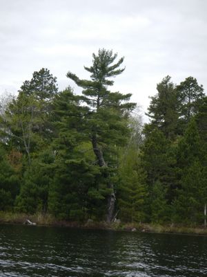
Having first dropped my van off at the Slim lake (EP #6) landing, our shuttle arrived at the boat landing on Big lake by about 10:00. Big is a motorized lake and, as we were loading up, a boat was coming off the lake & another was just pulling up to the dock. Fortunately, we would only see one other boat on our paddle across this lake.
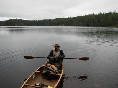
The subtle sounds of the canoe & paddles cutting through the water was a sweet serenade that was a long time in coming this year. It was a gray, gloomy paddle but there was little wind to hinder us; so we made good time. This would be the first opportunity for me to really test out my new double bladed paddle; (Bending Branches Navigator) so I was both excited & nervous to see how it would perform. And, perhaps more importantly, how I would adapt.
It didn't take too long to settle into a nice groove. (IMHO it's a much more rhythmic style of paddling.) Although, with Clay using a traditional single blade, initially it took a little experimentation to keep the Black Pearl on course. Ultimately, I determined this paddle will definitely achieve it's main objective when we paddle with Aurora.
Skipped the first portage & had no problems finding the entrance to the river in the SW corner of Big lake. Water levels were high, but I think a canoe would be able to make it through at significantly lower levels as well. (Depending on beaver activity).
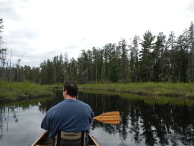
Supposedly the sun was to make a prolonged appearance today. But, it didn't appear that forecast would be proven accurate any time soon. Instead, it was our good fortune that the banks of the river were lavishly garnished with the bright pinkish glow of bog laurel.
We were now approaching Lapond lake. My Voyageur map shows a short portage over a peninsula in the river. We searched in vain for a landing, but came up empty. Paddling a little further upstream we found a beaver dam and quickly deduced that the water levels would be sufficient to float our loaded canoe. My, after the fact, assessment is that this portage is rarely, if ever, needed.
Encountered another small beaver dam at the entrance to Lapond lake that we were able to paddle right over. Then we headed straight east to check out the campsite.
Our target destination was the site on Big Rice. But, in the unlikely event that it was occupied, we wanted to check this one out too. Besides, it was nice to get out and stretch the legs a bit.
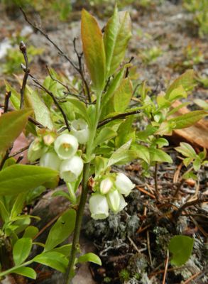
Couldn't say the same about the lake, but the campsite seemed better than average. There were some boulders strewn about but it had a nice landing, & few decent tent pads all situated under a canopy of mature red pines. It appeared it could even be a good spot for blueberries too.
Onward up the Portage river. The landscape on both shores was a bog for as far as the eye could see. Cotton grass was contrasted by the luxuriant soft pastel green of the newly sprouting tamarack needles. We also kept an ever watchful eye out for 'a pair of mobile satellite dishes'; as Clay termed it.
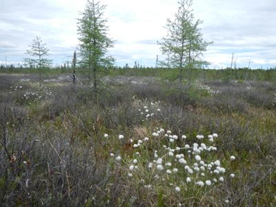
In short order, we pulled up to our first real portage of the day. It was a short (37 rods) and flat, narrow trail. There were, however, many overhanging branches as well as some roots and rocks to negotiate. Both landings were somewhat rocky as well. Undoubtedly the high water helped make them considerably more user friendly.
There was a slight variable breeze as we emerged onto Big Rice lake. It did little to hinder our progress, but since we just finished the portage - the cooling effect was much appreciated.
As expected, the campsite was vacant. So, we took a short detour over to the small island and paddled around the perimeter before finally pulling into the campsite landing to unload. The island appeared to be a neat area for future explorations.
For being such a swampy, boggy area we were both a little surprised that the campsite was situated up on a tiered bluff some 20 feet off the water. The landing was very rocky. Upon walking up on shore, Clay was taken aback by the golf ball sized 'mooseplums' near the landing. (we later found more scattered about the area & large swaths through the brush. Though we never seen the 'mobile satellite dished creature that created them.) As we worked our way up to the fire grate we startled a large garter snake sunning itself on the exposed rock face. To be fair - he startled me too.
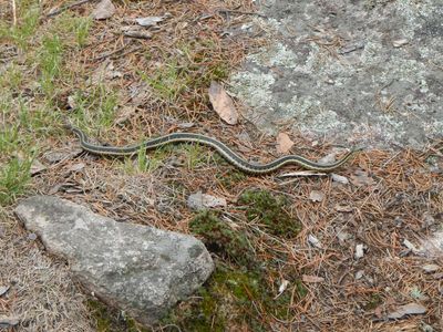
Apparently we embarrassed him to such an extent that he left the camp and didn't show himself again. (Which I was thankful for.) Since the forecast for the next couple days didn't call for rain, I didn't bother setting up the CCS tarp. But, we did pull the hammocks out. There was a fine stand of jack pines just off the fire grate area which worked well for just that purpose. It was a great feeling to finally be in a canoe country camp taking it all in.
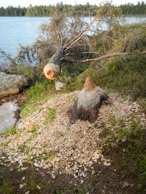
There was clear evidence that this campsite was also home to a busy beaver. In our search for firewood, we came across some large downed trees. Hopefully there weren't any near our tent pad that were on his list.
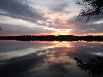
After getting some firewood up, it was time to get the steaks going. We continued processing the firewood while supper was cooking. And, later, enjoyed the fruits of our labor with a tasty meal & glorious sunset.
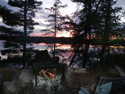
Saturday, June 08, 2013
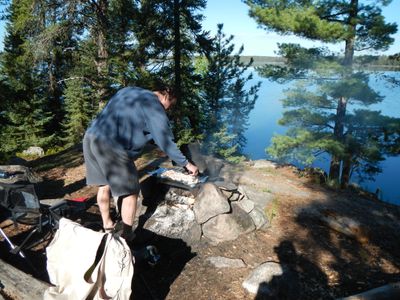
A breakfast of bacon & pancakes was enjoyed under a clear blue sky. The plan for today was to retrace part of our route from yesterday, then head for the sand beach of Big Moose lake.
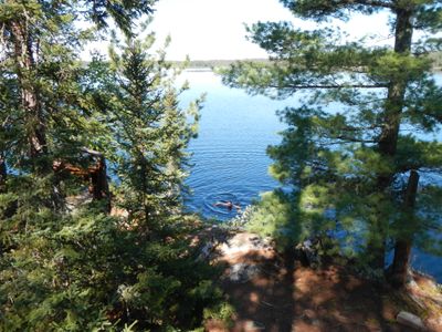
Before we headed out, Clay decided to take a dip and clean up a little. Big Rice is a very shallow lake. Still, with the late spring, the snow & ice hadn't been gone long enough for my comfort, So, Clay braved it alone.
Since the wind was staying down, we kind of arc'd our way around Big Rice back to the mouth of the Portage river. Just downstream from the portage, on the east bank, is a large stone that I believe is a Dolmen. I noticed it yesterday, but now stopped to take a closer look.
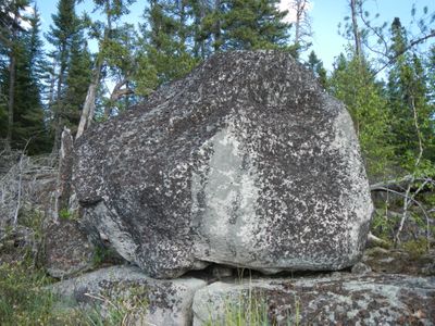
Regardless of it's official classification, it was a unique stone to see in the midst of this large bog. Just after paddling into Lapond lake we scared up a whitetail buck deer. Then, just after re-entering the river we seen a pair of mallards up on the same high rock knob as yesterday. (we would see them on our return later this day as well.) Seemed kinda weird they would hang out up there versus somewhere on, or very close to, the water.
Once again, the bog laurel covering the shorelines really made paddling down the Portage river a special affair. And, the sun being out in full force really heightened the color explosion.
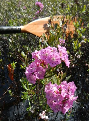
Expecting complete solitude as we worked our way down the Portage river towards the Duck lake portage, we were absolutely stunned to run across another canoe heading up river. Never the less - we informed them of the campsite situation in the area & wished them well as they paddled by.
One nice thing about paddling through this type of environment, is that anywhere that has been trodden on - sticks out like a sore thumb. Consequently we had no problem locating the portage to Duck lake.
Obviously, this trail started out as a bog walk. Though, I was surprised how quickly it morphed into the more traditional (solid ground) type of trail. For the most part the trail was a faint, somewhat overgrown path. But, we had no problems navigating our way to Duck lake where a unique large granite slab served as a landing.
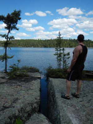
Since Duck lake was mostly surrounded by a large bog I thought we might have some trouble locating our next portage. Fortunately it was also very easy to locate.
Vickie & I had brought Aurora across this trail when she was only 3 months old. It still ranks as one of our most memorable trips. And, this trail was a big reason why. For example, remembering bouncing on the bog or the opening just past Duck creek where Vickie had changed Auroras' diaper..... Needless to say I was a little nostalgic as we passed through.
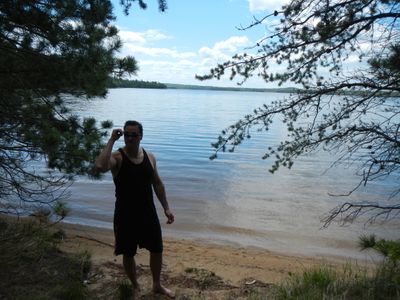
Also, since we presumed the 2 guys we'd passed on the river earlier were going to claim the Lapond lake site, we decided to have our lunch near the Big Moose lake beach. (Having recent experience with this portage, I knew there was a large opening just off the main landing and we wouldn't interfere with anyone who was trying to access the trail.)
Once there, it was amazing how much higher the water was! Never the less we cleaned up a bit in the sandy waters & had a nice lunch of rice & sausage before heading back.
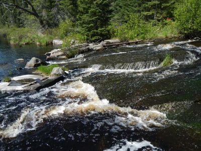
On the way back to Big Rice we stopped & lingered at the portage for awhile. I thought the rapids at the downstream side were sort of unique.
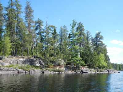
Weather wise it had been a long over due - gorgeous day. So, after arriving back in camp, the better part of the afternoon was spent in the hammocks reading our books and then eventually napping. There was enough of a breeze to keep the bugs at bay, so life couldn't have gotten much better.
Our last night on Big Rice was spent lackadaisically milling about camp. With the Hook lake portage prominent on the agenda for tomorrow, we both decided to turn in early.
Sunday, June 09, 2013
A quick oatmeal breakfast & we were packed up and ready to go.
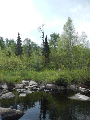
The portage to Hook lake was just a short paddle south from the campsite. As expected, we had some trouble finding the landing. The location was wrong on my Voyageur map. Clay got out and bushwhacked along the shoreline. The landing (if you want to call it that?) was actually about 50 yards further south down the shoreline. The photo provided shows what the landing looks like from the lake. The trail actually runs just under the spruce tree with the taller dead spire right next to it.
Regarding landmarks, there's nothing that will immediately jump out at you. I can say the landing area seems to be the grassiest spot in the area. Also, there is a huge slanted rock just to the left of the trail. But, it will likely be hidden until you're right on top of it.GPS coordinates are - N 48 01.505 W 092 01.284
Well here we go. The landing is a horrible rocky mess & the grass does a great job disguising their location. After pushing through the tall grass you will actually start to see a trail. It was very wet & muddy. After about 15 - 20 rods the trail opens up to reveal a large beaver dam & the corresponding pond just above it.
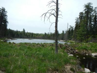
It may be hard to discern? But, the trail heads up the left side and follows the ridge the length of the beaver pond before finally pulling away into the woods. Shortly after this there is a narrow passage between 2 large boulders that seemed to serve as a gateway. (At least to me it did)
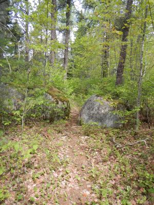
While there were always trees along the way, the forest was never a thick dense jumble. This created some minor problems when the trail abruptly took an unexpected sharp turn. On a few occasions we kept going straight. But, in each instance, we quickly regained our bearings. Often times there were rock cairns showing the way.
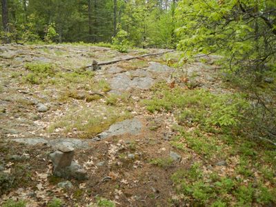
About a third of the way across, I made the determination to leap frog this portage. So I set my load down & headed back for load #2. Clay was compelled to make it to the end, so he continued down the trail.
There was a little of everything on this one. Including an area where the trail seemingly ended at a small pond. Clay found that the water was only about 10 inches deep & the trail was dry again after about 50 yards of wading. In normal conditions this spot would likely just be a muddy area.
Without question the general consensus most people come to is - try to avoid longer portages due to the extra exertion required to complete them. I'm not trying to say I never get tired or sore, but one of the aspects of long portages that I enjoy is the potential opportunity to experience a bountiful variety of micro-ecosystems. And, in that respect, this trail did not disappoint. From walking past a beaver pond, then to decaying leaves, pine duff, muddy spots, a small brook, a few swamps, several granite knobs....there were even some of the scrub oaks that Sigurd Olson spoke of (in "The Singing Wilderness") along the way!
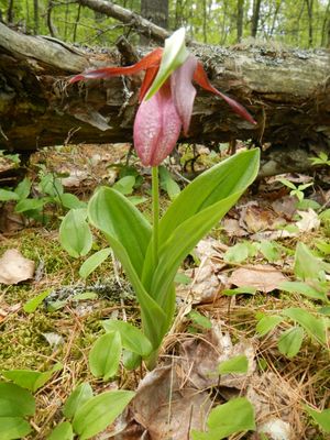
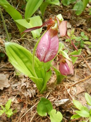
Coincidentally, at one of my drop spots while leap frogging, I happened upon a magical spot. At first I only noticed a few but, upon further investigation, noticed several others as well. In the end, this was the largest concentration of pink lady slippers I recall running across. There were dozens of blooming plants! This helped put some extra wind in my sails for the final push.
A section of the final swamp before Hook lake looked almost pre-historic. It was also the last spot where we temporarily lost the trail. There is a path that continues straight ahead up a gentle rise & leads to a spot that perhaps was the landing at one time when the water level was much higher. (perhaps a beaver dam had given out?) The actual trail veered sharply left once across the swamp.
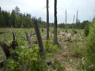
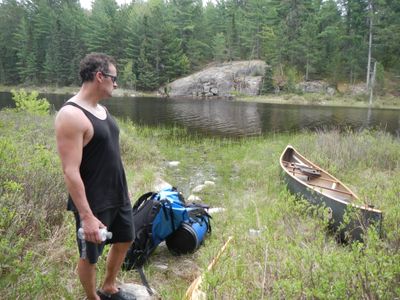
Even though we employed different strategies for completing the portage, we both had finished within a couple minutes of each other. In the end it took us approximately 2 and a half hours to double portage. A long - tough portage to be sure, but the accompanying sensory pallet overload (sights, sounds, smells) kept our minds off the drudgery of the task.
Took a few moments to catch our breath, then headed out onto Hook. Pre-trip intel was that the campsite on Hook was the cream of the crop in this 4 lake chain. We were hopeful that it was available. Before we got there, as we were rounding the corner to head south, I noticed a yellow sign with a marker just below it.
The sign had St. Louis county stamped on it. Not that I'm hopping up on a soapbox here (as I enjoy running across things like this) but, it never ceases to amaze me how much 'trace' is out here. Even from government agencies! Anyways, the skies were looking a bit more ominous so, after a quick inspection, we pushed on.
As we rounded the horn we could see that the campsite was occupied. Although, with multiple packs open sitting down by the landing, it appeared as if they were either just getting there - or about to leave. We paddled slowly by hoping for a tell tale sign. In the meantime, we admired the impressive rock outcropping directly across from the site.
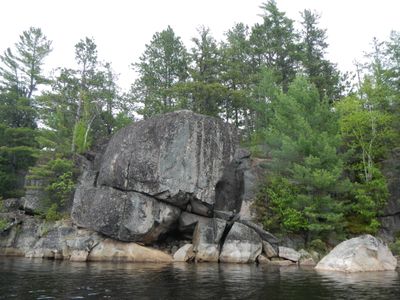
Since they seemed to be in no great hurry,(nor did we want to pressure them in any way) we decided to paddle over to the Keneu lake portage. The campsite would be visible from the portage so we hiked across, sans any gear, to check the occupancy status of that site.
The trail runs along the base of an impressive bluff. And, before sauntering down the portage, we couldn't resist crawling up to the top to see what we could see. We were immediately rewarded with a nice view back down Hook lake. And, since red pine was the predominant tree in the area, further exploration along the ridge was relatively easy too.
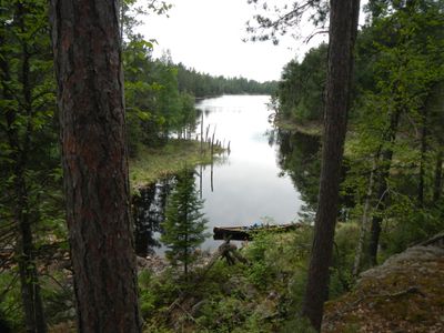
Eventually we worked our way across the portage. It was short & level but, had a lot of troublesome roots & rocks to negotiate. There were also a couple of tight spots where some trees had blown over. But, most fascinating of all was the large pile of fresh bear scat just off the trail.
The Keneu campsite was open. After some short deliberation, we decided to claim it versus waiting on the Hook site. The weather was starting to act up & we figured maybe the people at the Hook site would want to wait it out. And, if we could help it, we'd like to be able to get our camp setup before any rain let loose.
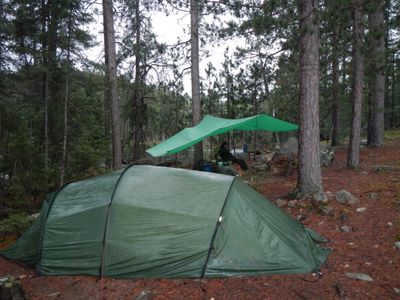
The Keneu site was an above average camp. Red pines dominated the immediate area surrounding the fire grate; which made for a nice airy, yet still somewhat sheltered, site. There were several boulders scattered about which limited good options for tent pads but, made for a really unique fire grate. The spacing of the pines also gave several excellent options for hammock hanging.
Everything was up and we were just putting the finishing touches on the CCS tarp when the rain let loose. Nothing serious, just a good ol' soaker. This was one of those sites that afforded us the rare luxury of being able to set the tarp up in such a manner that we were able to sit under it & stay dry, yet still receive a sufficient benefit of warmth from the fire without having to worry about damaging (melting) the tarp.
Next we put up some wood. Then we relaxed near the fire with our books before supper. After supper the rain eventually quit. We put up a little more wood then just hung out by the fire 'til dark. As we were crawling into the tent for the night, a soft pitter patter of rain started up again. Eventually escalating into an all night soaker.
Monday, June 10, 2013
The rain finally relented just before first light. I woke up for good sometime between 6:30 - 7. Not quite ready for the day, I decided to grab my book while still in my sleeping bag and read a little before breakfast. At some point during this period of time I could distinctly hear; what sounded like someone urinating near the fire grate. I knew it wasn't Clay, because he was still asleep right beside me. Since it had rained most of the night; I just presumed that noise was a result of me not getting the CCS tarp setup taught enough, causing a bladder of water to form & eventually let loose. So I went back to reading my book without giving it a second thought.
A short while later, as I was preparing pancakes for breakfast, Clay crawled out of the tent and sat down to have a cup of hot chocolate while he waited. The silence was shattered a moment later when Clay barked out an expletive. He excitedly claimed, " Look under that hammock. We had a wolf in camp last night!" "I know damn well that pile of scat wasn't there yesterday when I set it up. I would've stepped right in it." Upon closer inspection it appeared to be very fresh. (Had it happened last night, the constant rain surely would've deteriorated it some.) It was then that the light went off in my head about the urination sound I'd heard earlier. Wish I could've got a glimpse. But, I'm sure at the first sound of the zipper, he would've vanished in an instant. I did feel reassured in the fact that he left our food (blue barrel) alone. It was sitting on the ground only a few feet away from where he did his deed.
It was a cool misty morning. Never the less, Clay still opted to rinse off in the lake after breakfast. While we missed seeing the wolf, we were treated to another visitor that we did get to see. It was a loon. The first we'd seen on this trip. Strangely, we hadn't seen or heard any during our stay on Big Rice but, we did hear several Canadien geese while there.
While the clouds were still gray, the mist was slowly dissipating. So after breakfast chores were done, we hopped in the Black Pearl & headed for Ol' Baldy.
We were in no great rush, so we brought the fishing poles along. Success was immediate, as I hauled in a northern pike within a stones throw from camp. We retraced the portage to Hook & confirmed that the folks camping at that site had indeed left. Oh well. We were happy enough with the way things had worked out last night.
Next we hit the portage to Rice. It was a longer trail (130 rods) but, after a short moderate rise, was a pleasure to traverse. Although the amount of wolf scat on this, and all trails in this area, was palpable.
Just after completing this portage and pushing off into Rice lake we passed a couple of women heading the other way. Undoubtedly they would claim the Hook campsite.
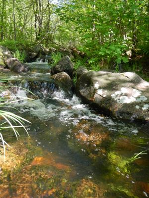
The portage to Slim started out very rocky. There was a very scenic babbling brook following the course of the trail. In fact the trail crossed it twice. Of course those spots were incredibly rocky, as was the put in on Slim.
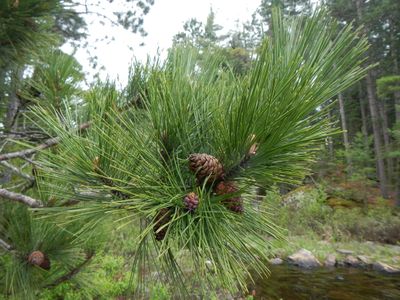
While the sky remained gray & overcast, there was no rain and very little wind so the paddle south down Slim was very pleasant. The first campsite we passed was vacant and, from what I saw in passing, didn't impress me much. The middle site was occupied and looked like a keeper. We were also impressed with the scenery of much of the lake. Large, sometimes exposed, granite bluffs dominated much of the shoreline. And, seeing the trees growing out of a sheer rock wall always fascinates me. We also got an idea where the portage back to the parking lot was for our trip out tomorrow.
Fortunately the southern most sight on Slim was unoccupied, so we pulled right in without disrupting anyone's solitude. This site had a nice landing, a decent fire grate area with a great view & at least 3 premo tent pads. Also, the trail up to Ol' Baldy originated here & was quite easy to locate.
The well worn trail begins climbing almost immediately. At some point, soon after leaving the campsite, I believe we technically left the BWCAW. (Don't tell anyone!) The bare granite quality of the knob gives an obvious clue as to how Ol' Baldy got it's name. From the top there is a nice view of Burntside lake.
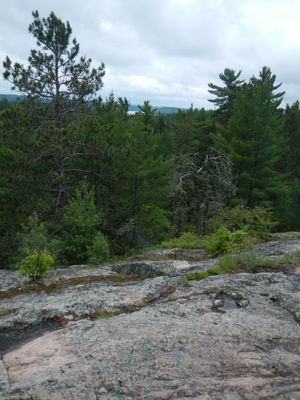
Of course Ol' Baldy was the, must see, pinnacle of these trails. But, we further explored the maze of various spur trails as well. (Although we turned back before reaching the road.)
As we paddled back, blue skies were becoming more evident. Once back in camp, we restocked the firewood pile then retreated to the hammocks for a little R&R before supper. This site was ideal for hammocks and afforded an excellent view while lounging.
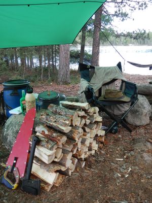
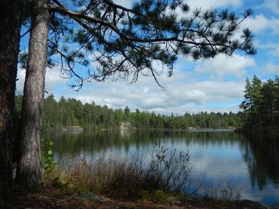
After supper we headed back out for an evening paddle around the lake. Our quiet solitary paddle around the mirrored liquid was only disrupted by the small northern pike we occasionally pulled in.
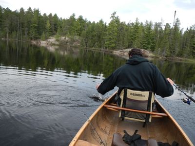
Our desire to fish eventually waned as evening drew near and we paddled back to camp. There we settled in & gathered around the fire grate to enjoy the ambiance of our small, crackling campfire. A beaver shattered our serene setting by flopping his tail on the water just off of shore. Seemed he was intent on the goings on in our camp as he swam back and forth from one side of the peninsula to the other.
Peaking my interest, I decided to follow him. In doing so, I stumbled onto a curious find out away from camp.
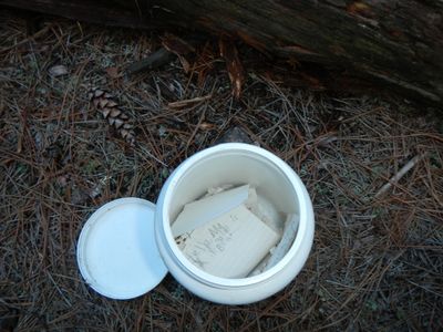
It was a message jar! In my pre-trip research I had read an old thread on bwca.com about this. I guess I hadn't thought it would actually be here so, I hadn't devoted any serious time or effort in searching for it.
There were several messages inside that dated back at least a handful of years. I had mixed feelings about this discovery. Certainly it was against the Leave No Trace rules. And, I wouldn't want to see this sort of thing all over the place but, I still found it very fascinating. So, as I did with the marker & sign found on Hook lake, I left it where I found it.
Afterwards, Clay suggested a great solution. He proposed we take it and put it near the middle of the portage to Big Rice. Then write "Last will & Testament" on the outside of the jar.
As our last evening wore on, there was a distinct 'chirping' sound just behind us. We both thought it was a baby grouse or some kind of bird. After finally narrowing down where the sound originated we were surprised to find that it wasn't a bird at all.
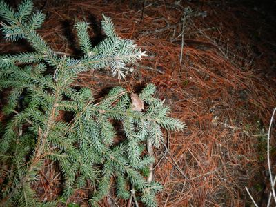
It turned out to be a small tree frog. With that mystery solved, we headed off for bed.
Tuesday, June 11, 2013
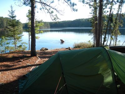
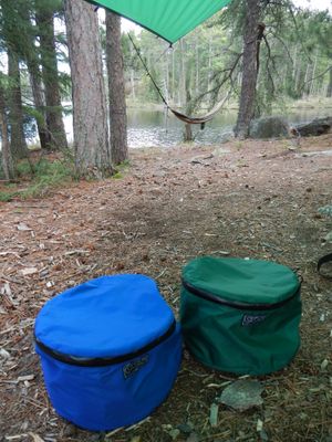
Once again Clay started the day off with a cool dip in the lake. I started packing things up before making us a quick oatmeal breakfast. Another gear review: This was the initial trip using the CCS barrel bags. They certainly were incredibly handy keeping the meals organized and avoiding the 'yard sale' while looking for a particular item. Although, I feel they're a bit pricey. But, as with all CCS gear I've used to date, the quality is superb & I'm sure they will last a lifetime. So, in the big picture, it's a worthwhile investment.
Loaded up, we began the journey out. We were intimately familiar with the current conditions of the portages so there were no big surprises today. That said, we were cruising across Hook lake at a pretty good clip when we paddled right past a baby snapping turtle. We also noted a pink lady slipper on the Hook ~ Rice portage that must've bloomed since yesterday. And, since it was sunnier than when we passed through the first time, the rays of sunlight breaking through the trees really gave the Rice ~ Slim portage a special enchanted feel.
he paddle south down Slim was highlighted by a low flying bald eagle patrolling over the skies just above the lake. We were hopeful of witnessing a dive for a fish, but that never materialized.
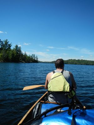
As unbelievable as it may seem, for the first time in my experience, paddling was hardly even necessary because - FOR ONCE - we actually had the wind at our backs pushing us in the exact direction we needed to go! Soon we entered the scenic little bay where our last portage was located. The landing was easy to locate, as well as being very accommodating.
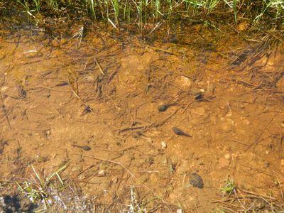
The portage back to the parking lot was as easy as a 140 rod portage could be. Quite literally you could've driven on a vast majority of the trail. A wide open root & rock free path with no discernible elevation changes. There were a couple of small bridges running over the small brook that paralleled the trail for a distance. Since the water was high, this provided an excellent opportunity to witness some small rapids & whitewater hydraulics that normally wouldn't be there. In fact the water was so high in some spots that we had to share the trail with some tadpoles.
Once the van was loaded up, we headed for the Boathouse in Ely. After devouring a couple of monstrous burgers, we hit the road for home.
After it was all said and done. This trip offered us more than I realistically expected going into it. Surprisingly, the campsites on Lapond & Big Rice were both above average IMHO. And, although we did see one other canoe, I think you'd be hard pressed to find an entry point that can provide almost instant lasting solitude with as little effort as is required to get to either of these sites. I think we hit the flower bloom just about perfect and were treated to many colorful blossoms throughout our journey. We didn't spend a lot of time fishing but, when we did, we were greeted with sufficient success (albeit all northern pike). It wasn't the most noteworthy trip for wildlife sightings, but the amount of scat (especially wolf & moose)throughout this area was a clear indication to me that the chances for those type of sightings should be very good if one were to take the time to do so.
Along with aiding navigation on the river stretches, the high water level meant we got to see some neat rapids & small hydraulics in the little creeks & rivers. Since the area was very wet, Deet was invaluable and kept the bugs at bay. I really didn't get bit much, but they an ever present pest when the sun wasn't out. Clay wore shorts much of the time and had more of a problem with ticks than anything else.
Besides the couple of items I've already mentioned. I did have a new pair of NRS wet socks along. These also performed very well. So, I can now say with certainty that I'm satisfactorily happy with all my new major gear purchases for this paddling season.
Once again, I realize this little vestige of the BWCA doesn't get a lot of attention due to lack of good fishing and difficult portages - (if you'd like to move on.) But, if you're main objective is quick/easy solitude? These one campsite lakes (Lapond & Big Rice) will be awfully tough to beat.
