Route Planning
Last updated by bstrege on 12/28/2013 7:32:28 PM
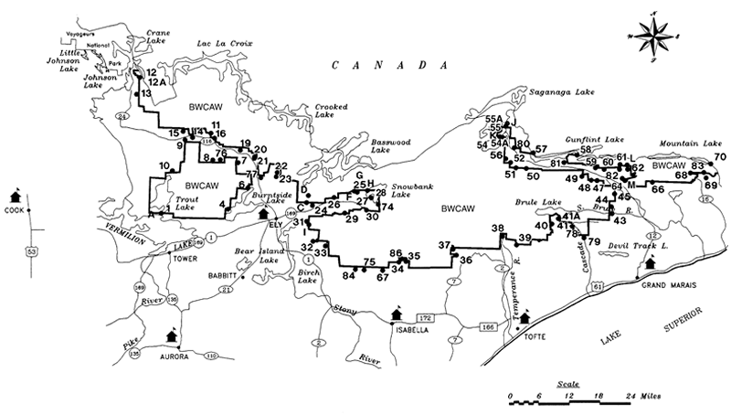 Where Should I Go?
This is a good question. It depends on the goals of your trip. You should be able to find an area that would suit your goals. By asking yourself the following questions, you should be able to find entry point and destination that suits your goals.
- How far do I want to paddle? I generally paddle in one day and then stay there. But I paddle really hard that first day. I do this because I don't like taking down and setting camp up again. You can decide to travel every day, or you can plan to paddle a few days and take a few layover days. One thing you have to keep in mind while planning is the weather. You may end up taking an unscheduled layover day because of wind or other adverse weather conditions.
- Do you want to do a loop or come out the same way you came in? This kind of ties into the last question. Additional planning, though, is needed if you want to do a loop. Loops generally, though not always, end at a different point than you came in at. You may have to park a vehicle at the exit point. Alternatively, outfitters in the area will, for a fee, pick you up at your exit point and take you back to your entry point.
- What do I want to see? There are many things to see and do in the BWCA. There are waterfalls, wildlife, pictographs, fishing, rivers, rapids, hiking, and so many other things to see and do. Find somewhere that you are interested in visiting.
- Do I want solitude? If this is one of your goals, I have found several ways to find solitude:
- Go a long ways in. This is the obvious one. It is most crowded on the lakes close to entry points. Usually, the further you go from the entry point, the less people you see.
- At least one long portage. Many people are not equipped for long portages, not to mention that they can be tough. Putting a long portage behind you also means leaving a lot of the people behind you.
- Secluded campsites. I have managed to find seclusion even on busy lakes. You just have to find the campsites on the lakes that are out of the way, off of the main travel routes. On a July 4th weekend, my wife and I basically managed to not see anybody the entire 4 days on a heavily traveled lake because we found a secluded campsite.
- What kind of campsite(s) am I looking for? You can only camp at designated campsites. These are campsites with a fire grate and a latrine. Of course, some campsites are better than others. Large groups really limit the sites that you can camp at - there are only so many decent tent pads at each site, and you can't harm any trees to make any more spaces for tents.
- How important is fishing? Some lakes are better than others. Also, not all lakes have the same species in them.
- How many portages and how long should they be? Portaging means packing your canoe and gear overland from one lake to another. Most portages in the Boundary Waters are well maintained. A few points on portages:
- The difficulty of portages depends on several factors: distance, elevation changes, pack weight (don't forget food), canoe weight, loose items that you have to carry, and how many trips you have to make (which is referred to as single portaging, double portaging, etc.).
- The type of packs you have also makes a big difference. Coolers are very difficult to carry for any distance. Hiking packs, of course, are made for hiking, but they don't fit very well in canoes. Duluth packs (and similar packs made by other companies) have been specifically made for canoeing. They are basically heavy canvas sacks with straps. Duluth packs wouldn't do very well on a long backpacking trip, but they fit well in canoes, are easy to waterproof (by using thick plastic bags or liners), and are comfortable enough for portaging.
- Portages are measured in rods - 1 rod = 16 1/2 feet, 320 rods = 1 mile. A rod is about the length of a canoe.
- How far do I want to drive? This may or may not be an issue for you. The Boundary Waters extends over much of northeastern Minnesota. Getting from one end to the other, even in a vehicle, can take up to 5 hours or more. Since I live closer to the western end of the BWCA, I tend to trip more on the western side. However, if this is a "once-in-a-lifetime" trip, or even a once-a-year trip, you should not take the driving time difference into account. Go where you want to go and don't let the decision be made by driving distance.
History
Permanent Link


